Land id®
- 4.1
- Rating
- 100.00K
- Installs
- Free
- Price

 Analysis by App-foxy
I found Land id® most useful when I needed to understand a piece of land without relying on a paper map, a vague address, or several separate searches. It is a free productivity app from Land id™ that brings boundaries, ownership information, and parcel details into a map-based experience. That combination makes it especially practical for landowners, buyers, outdoor users, and anyone trying to identify what a particular property represents on the ground.
My overall impression is positive, but it depends heavily on your expectations. This is not a general-purpose navigation app, and I would not treat it as a replacement for a survey, title research, or official legal documentation. Its value is in helping me investigate land quickly, organize my understanding of a parcel, and decide what deserves closer attention. The app has reached over 100 thousand installs and holds a 4.1 average from around 1.1 thousand ratings, which feels consistent with my experience: useful and focused, though not friction-free for every kind of user.
How clearly the map experience communicates land information
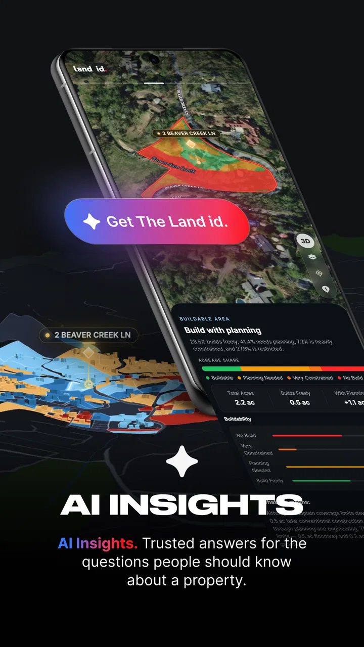
The first thing I noticed is that the app asks me to think in terms of parcels rather than ordinary streets and destinations. That sounds simple, but it changes how I use it. Instead of entering a business name or looking for driving directions, I examine the shape of a property, compare it with nearby parcels, and inspect the information attached to that area. For land research, this is a much more direct starting point than a conventional map app.
You May Also Like

 Blood Strike: 2.5 Anniversary
Blood Strike’s Loadouts Turn Every Drop Into a Tactical Gamble
A close look at Blood Strike’s custom loadouts: how fast access to signature weapons reshapes its battle royale rhythm, rewards preparation, and narrows the gap between fights.

 Pandora - Music & Podcasts
Pandora’s Music Is Easy to Start, but Harder to Recover
Pandora’s strength is its low-effort path from a seed to a station. Its weak spot is how much confidence it asks you to place in connection, setup, and quiet recovery.

 8 Ball Pool
 Is Built on Rivalries, Rematches, and Routine
A close look at the rivalries, rematches, shared routines, and unanswered safety questions that turn a quick pool match into a persistent mobile community.

 Samsung Music
’s Quiet Strength Is Playing What You Already Own
Its reach comes less from spectacle than from dependable access to a personal library. That simplicity is both the app’s strongest retention engine and its ceiling.

 AccuWeather: Weather Radar
AccuWeather Review: A Quick, Clear Forecast for Everyday Decisions
For everyday plans, the best forecast is the one you can understand quickly. AccuWeather makes rain timing, radar, and local conditions easy to act on, with a few trade-offs.

 Hill Climb Racing
Why Hill Climb Racing Still Turns Crashes Into One More Run
A tiny car, a bumpy hill and one more upgrade: Hill Climb Racing keeps resurfacing because its simple chaos makes every near-miss feel personal.
More From Our News Desk
View All News


Readability matters here because property maps can become visually dense very quickly. Boundaries, labels, roads, waterways, and neighboring parcels may all compete for attention. I found the experience easiest when I zoomed in gradually instead of trying to understand a large rural area in one view. At a closer scale, the relationship between a parcel and its surroundings becomes more meaningful; at a wider scale, the screen can feel more like a reference chart than a clean map.
The most helpful habit is to treat the map as an investigation tool, not a single-answer screen. I usually begin with the broad location, identify the likely parcel, then zoom and inspect the surrounding boundaries before drawing conclusions. That extra step is important because a nearby road, driveway, stream, or building can make a parcel look different in real life from what I first expected.
Navigation should feel familiar to anyone who has used a map application, but the purpose of each action is different. Panning helps me compare neighboring land, while zooming is essential for separating one boundary from another. I also found that patience helps when switching between general location awareness and detailed parcel inspection. Users who expect an instant answer after entering a location may find the process slower than a normal address search.
The text and map elements are clearest when I keep the display uncluttered and focus on one question at a time. For example, I might first locate the property, then check its ownership information, and only afterward examine nearby parcels. Trying to interpret everything simultaneously makes the screen harder to scan, particularly for people who have difficulty distinguishing fine lines or small labels.
The app is available for users aged Everyone, which makes its subject matter broadly approachable. In practice, though, “easy to use” depends less on age and more on comfort with layered maps and property terminology. A first-time land buyer may need a little time to understand what the boundaries and parcel records mean, while an experienced property user will probably move through the same screens more confidently.
Useful reading strategies for different users
I recommend increasing the device’s general text size if small labels are tiring to read, but I would not assume that every map element will enlarge equally. Map graphics, boundary lines, and labels do not behave exactly like ordinary paragraphs of text. For someone with low vision, a larger display, strong screen contrast, and a slower zooming routine may make the difference between a useful inspection and an exhausting one.
People who process visual information more comfortably in stages may benefit from writing down the parcel address or location before opening the app. That reduces the need to remember several details while moving around the map. I also prefer taking notes outside the map view when comparing multiple properties, because switching repeatedly between parcels can make it easy to confuse one location with another.
For users who are new to land records, the app is most approachable when used alongside a plain-language question. “Who appears connected to this parcel?” is easier to work with than “I need to understand everything about this property.” Breaking the task into location, boundary, ownership, and follow-up questions makes the interface feel less intimidating.
Motor, sensory, and practical considerations during use
Map apps naturally require repeated touch gestures, and this one is no exception. Panning, pinching, tapping a parcel, and moving between views can be demanding for users with limited hand control, tremors, joint pain, or fatigue. I found that careful, deliberate gestures work better than quick movements. A stylus or a larger device may help some people select a boundary more accurately, although the experience still depends on the precision of the map and the user’s screen.
One non-obvious trade-off is that accuracy and speed pull in opposite directions. Moving quickly across a large area is convenient, but it increases the chance of selecting the wrong parcel or overlooking a narrow neighboring property. Slowing down improves confidence, yet it makes the app less suitable for someone who needs to inspect many locations in a short session. I would plan for shorter research sessions rather than expecting to browse indefinitely.
Visual fatigue is another realistic concern. Looking at thin boundary lines and small map details for a long time can be tiring even for users with good eyesight. I found it better to pause after identifying a parcel, record the useful information, and then return to the map only when I had a specific comparison to make. This is more comfortable than continuously scanning the screen for clues.
Users with color-vision differences should be cautious when relying on map colors alone. A boundary or highlighted parcel should be understood through its position and surrounding context, not just its shade. If two visual layers are difficult to distinguish, zooming in and checking the associated information is safer than guessing from color. The app’s usefulness does not disappear, but the workflow may need to be more deliberate.
For people who are sensitive to visual motion or busy screens, a large rural map may be calmer than a dense urban one, but that is not guaranteed. Nearby parcels can still create a complicated pattern of lines. I would avoid rapidly zooming in and out and would keep the map centered on the property under review. That simple change reduces unnecessary movement and makes the task more predictable.
Auditory access is less central to this kind of app than visual access because the main work happens through maps and written property information. Someone who cannot comfortably inspect a visual map may need assistance or another source of information. I would not present the app as a complete solution for every accessibility need; its strongest support is for people who can use touch navigation and read map-based details with suitable device adjustments.
A realistic everyday scenario
Imagine I am considering a rural home and want to understand where the advertised land ends before arranging a visit. I can open the app, find the general location, inspect the parcel shape, and compare it with the road, neighboring properties, and nearby features. If the apparent boundary does not match the wording in the listing, I have a useful question to bring to the seller or a professional.
That workflow is valuable because it prevents an early misunderstanding. A large-looking field may belong to several parcels, while a narrow strip beside a road may be part of the property even though it is easy to overlook. The app helps me form a more informed picture before spending time traveling or making a decision. It does not settle ownership disputes, but it can reveal where I need clarification.
For someone with motor limitations, the same scenario may require preparation. I would search from a comfortable seated position, use a larger screen if available, and save notes after each important discovery rather than repeating the same gestures. A family member or agent could also help with map manipulation while the user focuses on interpreting the information and deciding what to ask next.
Where the app fits better than ordinary alternatives
A standard navigation app is better when my goal is driving somewhere, finding a business, checking traffic, or following a route. It is usually designed around movement and destinations. Land id® is more appropriate when the destination itself is the subject of the investigation. Its parcel-focused approach saves me from trying to reconstruct property boundaries from unrelated map layers.
County or local government property websites may be preferable when I need an official public-record workflow, a formal document, or a jurisdiction-specific search process. Those sites can be less polished and harder to navigate, but they may be the right place for authoritative confirmation. I see this app as a convenient first pass and a practical visual companion, not as the final authority for legal or financial decisions.
Printed plats and professional surveys remain stronger when exact measurements or legally dependable boundaries matter. They can be slower to obtain and less convenient to carry around, but convenience should not be confused with precision. If I were planning construction, resolving a boundary disagreement, or signing a significant purchase agreement, I would use the app to prepare questions and then rely on the appropriate professional or official source.
Compared with manually searching several websites, the app’s main advantage is continuity. I can stay focused on the map and the parcel rather than repeatedly changing search methods. That reduces mental overhead, especially when comparing adjacent properties. The trade-off is that a specialized interface can feel less forgiving when I do not yet understand the terminology or when the information I want requires interpretation.
Workflows that make the app more useful
My preferred workflow is to begin with the property’s general location, confirm the surrounding roads and neighboring parcels, and only then study the ownership information. This order prevents me from attaching the right information to the wrong piece of land. It is a small discipline, but it matters when several parcels sit close together or have similar shapes.
A second useful approach is to compare the map with what I can see on site without assuming they will match perfectly. Fences, worn tracks, landscaping, and informal access routes may not represent legal boundaries. If I use the app during a property visit, I treat those physical clues as questions rather than proof. This is one of the clearest ways to avoid overconfidence.
A third tip is to use the app before making a call, not after a disagreement starts. Reviewing the parcel layout ahead of time gives me more specific questions for an owner, agent, neighbor, or local office. Instead of asking vaguely about “the land,” I can ask about the narrow section beside a road, the apparent overlap with a neighboring parcel, or the access route shown near the property.
The free seven-day trial makes it easier to test whether this workflow suits me before committing to extended use. I would use that period purposefully rather than casually: inspect the locations that matter, test readability on my device, and decide whether the parcel information is relevant to my needs. In-app purchases range from $14.99 to $799.99 per item, so I would pay close attention to the purchase screen and choose only after understanding the intended duration or scope.
That pricing range is a meaningful consideration for occasional users. Someone researching one property may find a short trial or limited use sufficient, while a land professional could value continued access more highly. I would not subscribe simply because the map looks interesting. The right decision depends on how often I investigate parcels and whether the app saves enough time compared with local records and other tools.
Remaining barriers and situations where I would skip it
The largest barrier is interpretation. Seeing a boundary and ownership entry does not automatically explain access rights, easements, restrictions, recent changes, or the legal status of a dispute. A new user may mistake a clean map for a complete property report. The app would be a poor choice if I needed certainty for a transaction and was unwilling to verify important details elsewhere.
Another limitation is the physical nature of map interaction. Users who cannot comfortably perform pinch and drag gestures may find the core experience difficult even if the information itself is relevant. People who depend on non-visual interaction should also approach it cautiously because parcel research is fundamentally visual. In those situations, assistance from another person or a different information channel may be more practical.
I would also skip it for ordinary turn-by-turn travel. If I only need to reach an address, this app adds a layer of property research that I do not need. Likewise, hikers looking primarily for trails, live route guidance, or outdoor navigation may be better served by an app designed around those activities. Its strength is focused land context, not broad navigation.
Connectivity and field conditions can affect any map-based workflow, so I would avoid making the app my only source during an important visit. Before heading somewhere remote, I would gather the key property details in advance and keep alternative notes available. That is not a criticism unique to this product; it is a sensible precaution whenever a task depends on a mobile map.
There is also a cognitive barrier for people comparing many properties. The app can help organize an individual investigation, but switching among numerous parcels may become confusing unless I maintain a separate record of addresses, observations, and questions. For a real-estate professional handling a large portfolio, a dedicated property-management system may be a better primary tool, with this app serving as a supporting map reference.
The current version is 5.44.0, and the minimum operating system is version 9. I would check that the device meets this requirement before planning a workflow around it. That is especially relevant for older phones or shared family devices, where updating the operating system may not be convenient.
My inclusive verdict for land research
I recommend Land id® to people who want a focused way to explore parcel boundaries, ownership information, and surrounding land context. It is particularly useful for a prospective buyer preparing questions, a landowner checking the shape of a property, or an outdoor user trying to understand which parcel lies beside a route. The app turns a vague land question into a visual investigation that I can begin from a phone.
Its inclusive value is strongest when the user can adjust the pace, enlarge the viewing environment, and work through one parcel at a time. The interface supports a practical, self-directed process, but it does not remove the challenges of small map details, touch gestures, visual density, or property terminology. Those barriers are manageable for some users and decisive for others.
I also appreciate that the app is free to install and carries an Everyone age rating, making it easy to try in a household or with a helper. Still, the in-app purchase range means I would test the experience carefully during the free seven-day trial and confirm that the cost matches my actual use. Occasional curiosity is not the same as a continuing need for parcel research.
My final advice is simple: use it to prepare, compare, and ask better questions. Do not use it as the sole basis for a legal conclusion, a boundary confrontation, or a major purchase. If you need ordinary directions, choose a navigation app; if you need formal certainty, consult official records or a qualified professional. For the middle ground between those two options, where I want a clearer picture of land before taking the next step, this productivity app is a genuinely useful companion.
FAQs for Land id®
01What is Land id® used for?
Land id® is a digital mapping and property research app designed to help users identify land boundaries, ownership information, parcel details, and other location-based data. It can be useful for homeowners, real estate professionals, land investors, hunters, outdoor enthusiasts, and anyone researching a specific property. Available information may vary depending on the location and the data provided by local public records.
02Is Land id® accurate enough for determining legal property boundaries?
Land id® can be a convenient tool for viewing approximate parcel lines and researching property information, but it should not be treated as a substitute for a licensed survey or official legal documentation. Mapping data may contain errors, outdated records, or differences in accuracy between regions. If you are involved in a purchase, dispute, construction project, or boundary decision, verify the information with the appropriate government office or a professional surveyor.
03Does Land id® require a subscription or include in-app purchases?
Land id® may offer access to basic mapping features while reserving advanced tools, premium data layers, or expanded property information for paid plans or in-app purchases. Pricing, trial availability, and included features can change over time and may differ between Android and iOS. Before downloading or subscribing, review the current payment terms carefully, especially automatic renewal conditions and cancellation requirements.
04Can I use Land id® without an internet connection?
Some Land id® features may depend on an active internet connection because the app needs to retrieve map tiles, parcel records, satellite imagery, or other online data. Certain plans or tools may support saved maps or offline access, but offline functionality should not be assumed for every feature or location. If you plan to use the app in remote areas, test downloads and offline maps before relying on it in the field.
05What privacy information does Land id® collect?
Because Land id® is a location-focused application, it may request access to location services and collect information related to your searches, saved properties, device, or app usage. The exact data practices depend on the current privacy policy and the permissions you grant. Before using the app, check its privacy disclosures and review location permissions, account settings, and data-sharing options to decide what information you are comfortable providing.
Pros
- Clear property boundary maps make land research easier.
- Useful for comparing parcels while viewing multiple map layers.
- Supports location sharing for coordinating with other users.
- Helpful measurement tools for checking distances and approximate areas.
- Clean interface makes basic mapping tasks easy to understand.
Cons
- Some advanced property details may vary by location or data source.
- Map accuracy can depend on local records and GPS conditions.
- Certain features may require a paid plan or in-app purchase.
- Large map areas may take time to load on slower connections.
- The app may feel excessive for users needing only simple navigation.

Land id®
Gallery